
A small satellite company has launched an AI service that analyzes satellite images through natural-language conversation, instead of requiring experts. Naraspace Technology said on the 3rd that it has released a beta version of its AI service, “EP Agent,” which can analyze satellite imagery through natural-language dialogue.
Satellite imagery is data that looks down from the sky at wildfires, floods, crop conditions, and urban changes. Its uses are broad, but it has been difficult to handle. Users had to go through several steps: finding the needed imagery, selecting useful data, and then running it through a separate analysis program. They also needed specialized knowledge to read satellite imagery and spatial information, as well as technical skills to operate analysis tools. That is why it has been hard for ordinary public officials or corporate practitioners to approach.
EP Agent bundles that process into a single conversation. It is offered through Naraspace’s satellite data platform, EarthPaper, and users can simply ask questions as if chatting, without specialized programs or analysis knowledge.
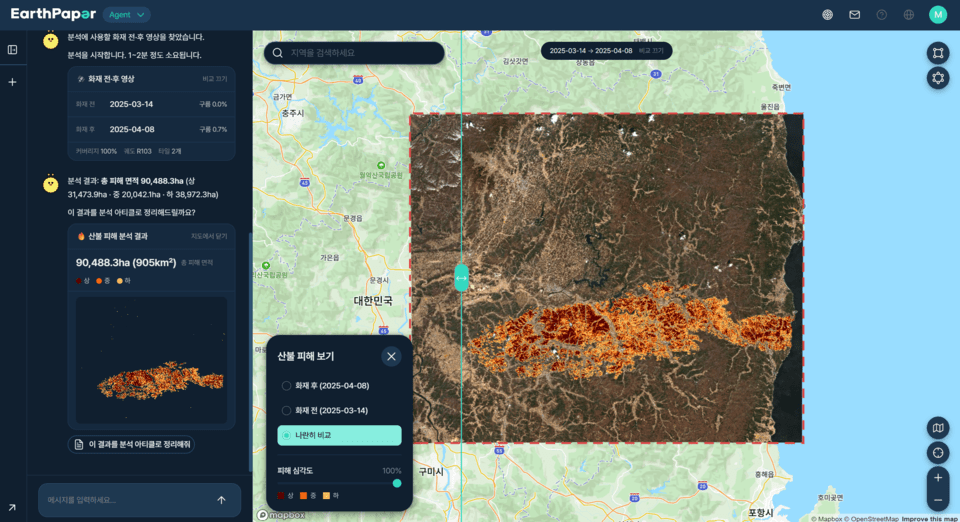
This beta version first includes wildfire damage analysis functions. The choice reflects demand for wildfire response in the fall fire season.
The usage is simple. If a user types, “Find wildfires that occurred in Korea in 2026,” relevant wildfire locations appear. After selecting a specific area and asking, “Analyze the wildfire damage in this area,” the service analyzes the damaged area based on actual satellite data. The results show key information such as the damaged area and damage grade, and it also generates a report summarizing the findings.
The speed difference is significant. According to Naraspace, until now, it took an expert several hours to analyze the damage area of a major wildfire of more than 100 hectares. With EP Agent, it can be finished in under 10 minutes. For local governments and forestry authorities that need to quickly grasp the scale of damage immediately after wildfire suppression, time is response capability.
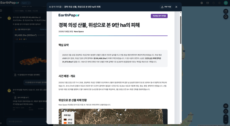
Naraspace emphasized that EP Agent is different from general generative AI services. Services like ChatGPT search public information on the internet and summarize it. By contrast, EP Agent directly analyzes actual satellite data using algorithms independently developed by satellite imagery analysis experts, and calculates the wildfire damage range and area numerically. In other words, it produces calculation results based on data, not merely plausible answers.
The company demonstrated EP Agent on the 2nd at the “Satellite Utilization Conference 2026” in Daejeon, showing the full process from satellite image search to wildfire damage analysis and result confirmation. One attendee who saw the demonstration said, “The process of asking questions as if conversing with AI, and then seeing satellite image analysis and report generation follow, was impressive,” adding that “it seems intuitive enough for users unfamiliar with satellite imagery to use.”
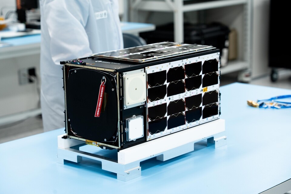
Naraspace is a KOSDAQ-listed company that successfully launched its self-developed small satellite Observer-1A in 2023 and later successfully launched and established communication with Gyeonggisaet-1 in November last year. It is considered one of the few companies in Korea that handles everything from satellite manufacture and operation to data analysis. EarthPaper is a platform that uses that data for applications such as forecasting food and raw material production and responding to wildfires.
“EP Agent is a service that makes satellite data understand the user’s language, instead of requiring the user to learn the language of satellite imagery,” said Oh Hyung-jik, director of Naraspace’s operations division. “It is the result of productizing the analysis methodologies and expertise accumulated through EP Post, which has provided satellite imagery analysis content on EarthPaper, so that more users can easily use it.” He added, “We will continue improving EP Agent so that satellite data can be used in real-world field judgment and decision-making.”
The company plans to expand its applications beyond wildfire analysis into landslides, forestry, agriculture, energy, and other industry-specific areas. As the key issue in the space industry increasingly becomes who can use satellite data, and how easily, this attempt by a domestic startup to lower the barrier through “conversational analysis” is drawing attention.